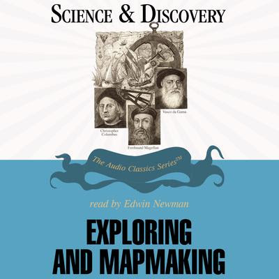
The “Age of Exploration” is today known for shameless imperialism, but it also saw many advances in our scientific understanding of the earth. As European explorers traversed the globe, they created maps of regions that had never been mapped before. They also were the first to scientifically describe some of the local flora and fauna. But the focus of this audiobook is more on advances in navigation, and how to create reliable maps of the areas that they were traveling.
The desire to create accurate maps began early in antiquity. Ptolemy may have been the one who first advocated having maps with a consistent scale – that is, where distortions were minimal. Before him, it had been common to enlarge the areas that were known to the mapmakers (or at least interesting to them), and to shrink the areas where there were embarrassing blank spaces. This kind of distortion would be unthinkable today, and it is partly because of Ptolemy that we now find this unacceptable in our maps. Some distortions are inevitable when you create a two-dimensional map of a three-dimensional planet, or even when you focus on an area about the size of an American state. They talk about the tradeoffs involved in different kinds of maps, some of which are still weighed and debated to this day.
Claudius Ptolemy
Another contribution that Ptolemy made was to point out the need for a latitude-longitude coordinate system. We don’t think about this much today, because we entrust most of this work to computers. But at this time, there was a real need to describe locations in a precise way. Latitude is a measure of how far north or south of the equator we are, while longitude describes how far east or west from the “prime meridian” we are (a concept agreed upon in the nineteenth century). The latitude problem was solved fairly early in the history, because you could use the stars in the sky to determine your latitude. The further north you were, the more northern constellations you could see. And the further south you were, the more southern constellations you could see. A little knowledge of astronomy, combined with a good compass (once invented in Ancient China), could go a long way in this area – although I should note that Europeans did not use compasses until the Middle Ages.
Diagram of a Chinese mariner’s compass, during the Ming Dynasty
The longitude problem would not be so easy. In part, this was because the distance between meridians of longitude is very different near the equator than it is near the poles. In fact, it varies for everything in between as well, at least when you’re staying in the same hemisphere. The key to longitude was accurate timekeeping, where you compared local sunrises and sunsets to those expected in the time zone that your clocks were corresponding to. But this was very difficult in earlier centuries, because clocks with the needed precision had not yet been invented. When such a clock finally was invented in the eighteenth century, the longitude problem was finally solved. This allowed for more accurate navigation around the globe, and more accurate mapping of the earth’s surface.
John Harrison, inventor of a clock precise enough to determine longitude
This audiobook refers to modern mapmaking as “scientific.” But by some definitions, this would be a misnomer. Unlike biologists or astronomers, cartographers don’t do much hypothesis testing, although they do apply principles discovered by the hypothesis testing of others. For example, they use arithmetic and geometry to apply the aforementioned coordinate systems. In this way, they are more like engineers than theoretical scientists. Regardless, the advances in this subject are fair game for a “Science & Discovery” series like this one. They belong in a discussion of the history of science, because they allow us to see the patterns revealed by the maps that they create. These kinds of maps are used every day – whether mental, physical, or electronic.
Portrait of a man said to be Christopher Columbus
This program does not ignore the political and commercial motives that drove the early explorers. Purely scientific voyages did not come until the eighteenth century. But their focus is nonetheless on the science, and what it tells us about the earth. This audiobook is an excellent fit for anyone interested in history, geography, or natural science. It will show you how the problems of navigating the earth were first studied, solved, and overcome.
If you liked this post, you might also like:
Part of an audiobook series
Science & Discovery
Exploring and Mapmaking
See also the audiobook series
The Giants of Philosophy
Others to be covered later


No comments:
Post a Comment